3D hexagon mapping Day 4 · Hexagons
A season of hotspots
2024 California Fire Season
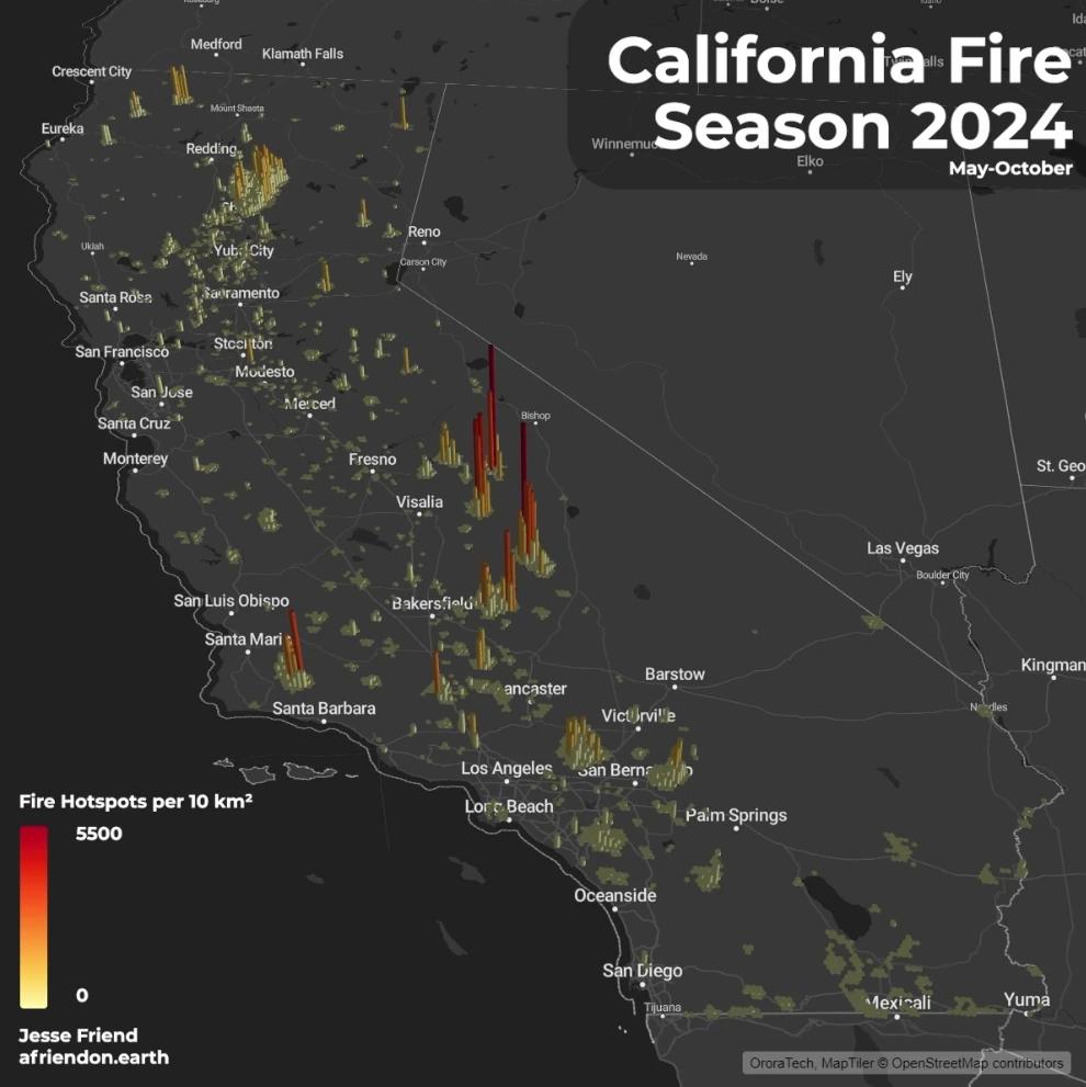
An interactive 3D hexagon map of the satellite fire hotspots detected across California from May to October 2024.
A closer look
After a historic fire season, I wanted to see how fire detections were spread across the state.
Each hexagon covers about 250 km² and rises with the number of satellite hotspot detections inside it, up to 26,643 in a single cell. I first built the map with deck.gl for the challenge. This interactive version uses MapLibre’s 3D extrusions, with hotspot data from OroraTech.